Here, I uploaded a bunch of free maps for you. Wooo!
July 2, 2017 5:09 PM Subscribe
National Parks Maps - 1,704 of them. Free to download! The National Park Service publishes tons of great free maps; Matt Holly has collected them all for you. On his website NPMaps you’ll find hundreds of PDF and image files of any U.S. national park map; you can view all parks alphabetically and sort by state.
Want to Browse Some National Park Maps? There’s a Site For That
Did you know -- Each of the park pamphlets follow a “Unigrid” design format developed in the 1970s. The format was invented to make design easy, minimize waste, and work horizontally or vertically. The brochures got their iconic look by none other than the acclaimed designer Massimo Vignelli, who is perhaps best known for designing New York’s subway signage and a subway map that made New Yorkers scratch their heads during the 1970s. Vignelli’s Helvetica-helmed Unigrid design is so iconic that it’s even in the collection of the Museum of Modern Art—not bad for a deceptively simple brochure.
smithsonian.com | May 9, 2016
Interview: Matt Holly of NPMaps
Modern Hiker | July 15, 2016
What Makes A Map Beautiful, According To A Parks Ranger
Fast Company Co.Design | June 28, 2016
My god, they're full of staircases.
posted by davebush at 6:15 PM on July 2, 2017 [2 favorites]
posted by davebush at 6:15 PM on July 2, 2017 [2 favorites]
Whoa! Now there's some fun right there.
Love me some maps.
posted by BlueHorse at 9:56 PM on July 2, 2017
Love me some maps.
posted by BlueHorse at 9:56 PM on July 2, 2017
Because “Here, I downloaded a bunch of free content from my employer, didn't link back to their site and monetized the fuck out of my own links for you, woo!” doesn't have the same ring to it.
posted by scruss at 6:39 AM on July 3, 2017
posted by scruss at 6:39 AM on July 3, 2017
Agreed the SEO and ad stuff is a bit obnoxious. But it's legitimate use of government materials. Also they have added enough structure and context to make this truly useful. It's well done.
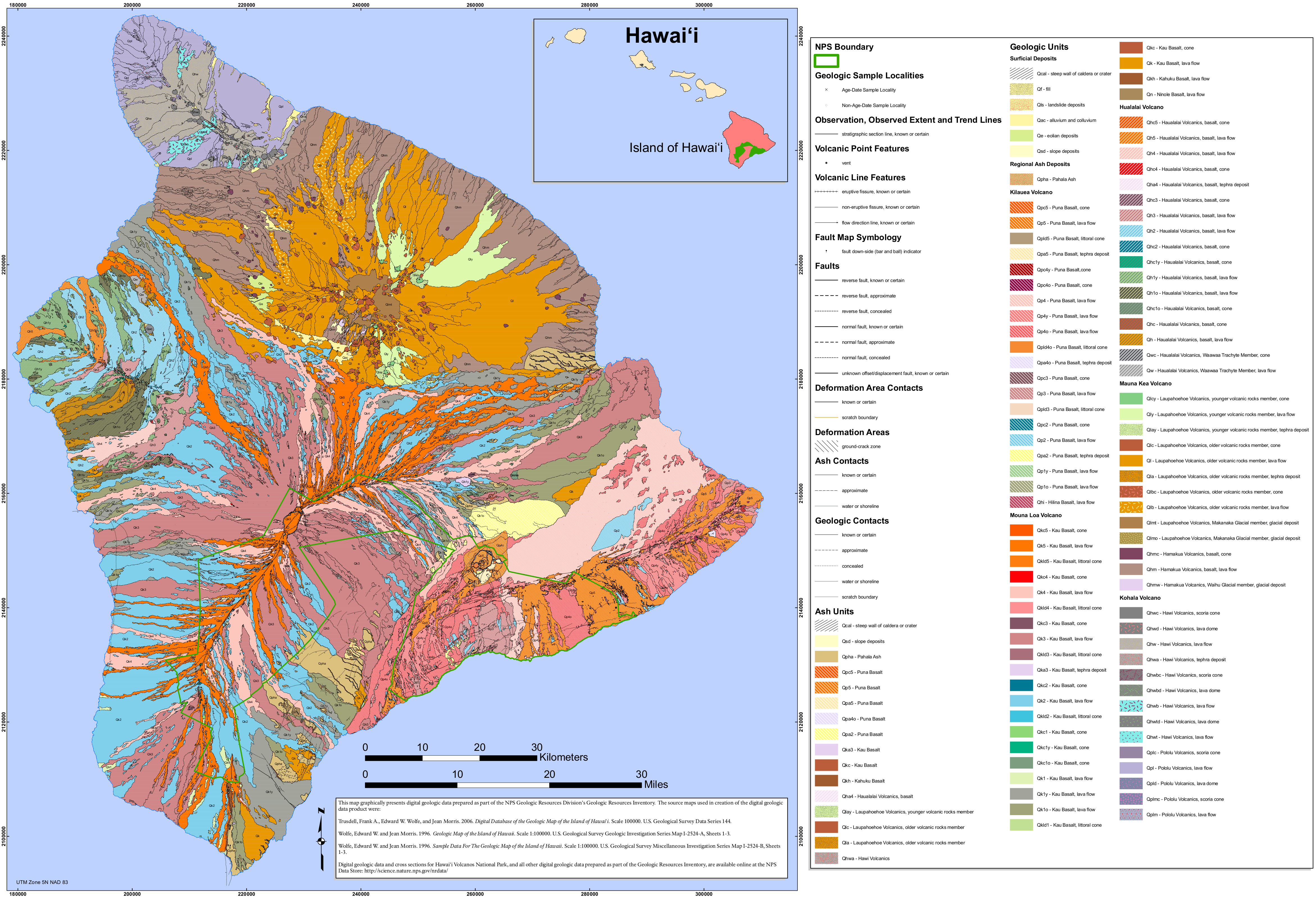
And hey, they have one of my favorite NPS maps, the Hawaii Volcanoes geologic map. Every lava flow that makes up the Big Island lovingly mapped in ~150 colors. I have the print version, what doesn't come through on screen is the bright-fluorescent-orange ink they used in the printing. It's very hard to make a map with more than about 8 distinguishable colors. This one has some 20 different base RGB colors, with like 7 variants of each. And then 5 or so fluorescent colors that contrast with the rest in a way you just can't do on a static computer screen.
posted by Nelson at 7:10 AM on July 3, 2017 [2 favorites]
So Mr Beaning says "thank you! so sweet! very nice!" He's been doing the maps for the local hiking group and I'm going to make him get his own metafilter account if he has more to say.
posted by beaning at 5:10 PM on July 3, 2017 [1 favorite]
posted by beaning at 5:10 PM on July 3, 2017 [1 favorite]
I immediately sent this to my friend whose job is maps.
posted by jenfullmoon at 7:55 PM on July 3, 2017
posted by jenfullmoon at 7:55 PM on July 3, 2017
« Older Hey there, Sparky! | On Cultivating a Personal Microculture, and the... Newer »
This thread has been archived and is closed to new comments
posted by Bee'sWing at 5:50 PM on July 2, 2017 [1 favorite]