LA Noir.
July 4, 2012 1:48 AM Subscribe
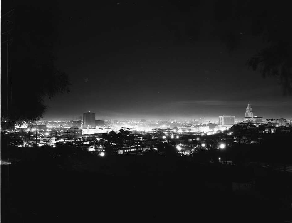
Since 2009, a thread on the Skyscraper Page forums has been dedicated to trawling for old photos and stories of Los Angeles, mostly from the LA Public Library and USC Archives. Thousands of posts have accumulated into a fascinating portrait of the city.
The thread is too vast for any one person to fully digest, and is best experienced as an ongoing narrative flow as stories are exchanged and mysteries are unravelled. but here are a very few scattered points of interest.
The beautiful Dorothy Adamson’s dog gets bombed. Ciro’s and Villa Nova beget The Comedy Store and The Rainbow Room. The elevated bicycle pathway to Pasadena.
The LA Times building is bombed and rebuilt. (supplement)
AAA of California provides helpful air directions. Largo begets the Roxy. An orgy is interrupted. (supplement: orgy site ceases to be eyesore)
Victorian houses, then and now. Hill & 6th, then & now. Bunker Hill, then and now. (plus the LA Pigeon Farm)
The incredible Old Dutch Chocolate Shoppe, which languished (but survived) as a cafeteria, flea market & cellphone store, but is now due for restoration.
LA's funicular railway Angel's Flight, since restored, decaying in storage. LA's other, long-forgotten funicular, Court Flight, decaying long before Angel's Flight had even been removed.
Old Venice.
LA's Chinatown was famously demolished to make way for Union Station, but was actually only one of four Chinatowns in LA.
The removal of the hill on Hill Street.
Massive earthworks for Dodger stadium. Streetcar livery survey A catalog of original Ralph's grocery store structures.
Alpine Tavern on Mt. Lowe, connected to LA by the Mt. Lowe Railway.
I wish I could do more, this just scratches the surface.
That first long link is apparently broken, it has nothing to do with beautiful Dorothy Adamson or her dog, or the elevated bike path, etc. which all sounds really interesting. But OMG that link! It's a perfect illustration of how I used to explain LA to people when they visited me. I would tell people about architect Robert Venturi's book "Learning from Las Vegas." He argued that cities were being designed as streetscapes to be experienced from cars, instead of urban landscapes to be experienced on foot. The scale matched the speed at which cars experienced it. He made an analogy to the air races in Nevada, traveling over predetermined routes around markers that were miles apart. The markers were just large pylons, something that could be clearly seen at speeds of 600mph. So I likened LA to that sort of navigation, driving from point to point across a mostly flat urban area, with large pylons as navigation aids to guide you. My favorite example was the Mutual of Omaha building on Wilshire Boulevard. It actually had a pylon on top, it was a landmark you could see for miles, even as LA started to build higher buildings that would obscure the wider vistas of the flat LA landscape. Alas the pylon has been torn down for no good reason, and I had to do a web search for a goo image of it, and of course I found it in the Skyscraper Page forums.
But until just now when I saw that thread in the mangled link, I had no idea that my metaphor for LA, flying from point to point, like navigating an airplane around pylons, was actual reality. This thread has photos of several airports spread across the LA area, I could not believe there was once an airport at Fairfax and Wilshire! That's almost exactly where the Mutual of Omaha pylon was. A little web research shows that the Rogers Airport opened in and continued until at least 1932, while the Mutual of Omaha building was built in 1929. The pylon on the top was a warning of a tall building and a navigational aid for aircraft heading for the Rogers Airport.
posted by charlie don't surf at 2:30 AM on July 4, 2012 [2 favorites]
Shoot, let me try that again:
The beautiful Dorothy Adamson’s dog gets bombed. Ciro’s and Villa Nova beget The Comedy Store and The Rainbow Room. The elevated bicycle pathway to Pasadena. (bombing supplement).
posted by anazgnos at 2:55 AM on July 4, 2012
The beautiful Dorothy Adamson’s dog gets bombed. Ciro’s and Villa Nova beget The Comedy Store and The Rainbow Room. The elevated bicycle pathway to Pasadena. (bombing supplement).
posted by anazgnos at 2:55 AM on July 4, 2012
This stuff is amazing and I love you for this post.
It's funny how familiar a lot of this looks just from my time on the beat playing LA Noire.
posted by Senor Cardgage at 5:15 AM on July 4, 2012
It's funny how familiar a lot of this looks just from my time on the beat playing LA Noire.
posted by Senor Cardgage at 5:15 AM on July 4, 2012
It really is quite a thread, and much like LA itself in its attributes: far-reaching and unwieldy, nearly impossible to navigate, slow loading, thematically schizoid, occasionally quite contentious (one long-time contributor recently removed all his posts/pix in a fit of pique, regretted it, and has been gradually restoring them), but worth dipping in every week or two to see what gems the obsessives have tracked down.
I do have some archival and attribution concerns about the important historical work being done here under pseudonyms, on a site whose longterm survival is not guaranteed, and whose search tools are abysmal ("This forum requires that you wait 60 seconds between searches. Please try again in 37 seconds").
Contributor "rick m" is actually Rick Mechtly, scholar of lost gay downtown and someone whose observations I wish were available in some more accessible format. Contributor "Beaudry" is actually Nathan Marsak, neon historian and chronicler of lost Bunker Hill and its cinematic fakes (self link).
If you dig this sort of urban rediscovery, an exhibition (self link) at Gary Leonard's downtown gallery this month will be of interest, as will Jim Dawson's new book about Bunker Hill and noir.
posted by Scram at 5:50 AM on July 4, 2012 [4 favorites]
Wow. Each one of these links on their own is amazing.
I love seeing the collection of photos in the "Old Venice" link; shots from throughout the 20th century of the arches over the sidewalks, the canals, the bridges. It's so easy to forget sometimes, in a city like LA, that there was any history at all. But just look at this guy with a beard. Who is he? How different from I must he have been? And yet, him and I have walked the same streets, and that's just fucking amazing.
Historical photography like this is what inspires me as a photographer. Most of these were not snapshots; they were composed and shot with skill and quality, even the stuff from the turn of the 20th century. These old photographs provide us with an invaluable window into the world of the past, and that need still persists today. Things are radically different, we are all photographers now. Google Street View gives us a catalog of virtually every street in the nation, the world. But when people want to know what Venice of the 2010s was like in 2100, hopefully there will be a record of large-format photography, like many of the shots from the link, artfully composed and skillfully exposed, available to those people.
posted by malapropist at 5:55 AM on July 4, 2012
Thanks for posting this. I've always been fascinated by old Los Angeles.
posted by entropicamericana at 8:52 AM on July 4, 2012
posted by entropicamericana at 8:52 AM on July 4, 2012
In the link regarding the airports throughout Los Angeles, I really enjoyed how someone realized that Cloverfield Blvd in Santa Monica was named after the Clover Aviation Field, which was located very near where the blvd now exists. Which means the film was named after a street which was named after an aviation field.
posted by RubixsQube at 8:52 AM on July 4, 2012 [1 favorite]
posted by RubixsQube at 8:52 AM on July 4, 2012 [1 favorite]
« Older "I feel like a free man." | Brick, snare, brick, snare Newer »
This thread has been archived and is closed to new comments
posted by carsonb at 2:13 AM on July 4, 2012