“As though the New Jersey suburbs were grafted onto South Carolina”
November 24, 2015 2:19 PM Subscribe
Florida is mostly part of the Northeast, but with better weather.
posted by Splunge at 2:37 PM on November 24, 2015 [1 favorite]
posted by Splunge at 2:37 PM on November 24, 2015 [1 favorite]
"Allow me to welcome you to the North, Maryland. I’ve always loved your well-appointed Interstate 95 rest stops!"
You're goddamn right. Maryland House and Chesapeake House are like model interstate rest stops that the rest of the country need to learn from. (I'm only slightly biased)
Also, I've always considered MD to be a northern state, especially since we're way north of the Mason-Dixon line. (I feel like other states that touch the line, even to the north of it, is still pretty southern. I'm looking at you KY.)
posted by numaner at 2:37 PM on November 24, 2015 [5 favorites]
I've always considered MD to be a northern state, especially since we're way north of the Mason-Dixon line.
Not sure if serious.
posted by zombieflanders at 2:41 PM on November 24, 2015 [16 favorites]
Not sure if serious.
posted by zombieflanders at 2:41 PM on November 24, 2015 [16 favorites]
South Florida is part of the Northeast, but North Florida is ironically The South.
posted by cuscutis at 2:42 PM on November 24, 2015 [12 favorites]
posted by cuscutis at 2:42 PM on November 24, 2015 [12 favorites]
That Northern Virginia link is really interesting.
posted by LobsterMitten at 2:43 PM on November 24, 2015 [2 favorites]
posted by LobsterMitten at 2:43 PM on November 24, 2015 [2 favorites]
All places south of Trenton are The South. Texas, New Mexico, and Arizona are Mexico. All states that get more money back from the govt than they put in are South; all states that pay in more than they get back are North. California is an Empire. Washington and Oregon are territories., hoping to become part of California. Alaska is the suburb of Canada. South Florida,ie, Miami, St Petersburg, Tampa, etc used to be The Bronx but are now a part of Cuba. Orlando is Puerto Rico.
Chicago used to be in the middle of the country but now is a subset of Fairfax, Va., home of NRA.
The Mason Dixon line once important for map making but since Mason began making jars and Dixon, pencils, no one pays much attention to it. Proof? put the terms into your GPS and see what Siri tells you
posted by Postroad at 2:52 PM on November 24, 2015 [12 favorites]
The south in my mind will always be composed of the states that seceded, which also explains why the classification of Missouri remains confused.
posted by florencetnoa at 2:55 PM on November 24, 2015 [7 favorites]
posted by florencetnoa at 2:55 PM on November 24, 2015 [7 favorites]
numaner: "You're goddamn right. Maryland House and Chesapeake House are like model interstate rest stops that the rest of the country need to learn from. (I'm only slightly biased)"
I'm almost ashamed that I have Opinions about this.
I still don't understand why the old Maryland House was demolished, because I thought it was pretty nice (especially the way that it was landscaped).
I stopped at the Chesapeake House today (which is an obvious step up from the old one, which was horrid) because they have Peet's, which is obviously better than Starbucks. The Chesapeake House might become my new default I-95 stop, because it has better coffee and cell service than Delaware.
Both of the new buildings are quite nice, even though they're a tad sterile. The employees are also unusually friendly for a highway rest-stop -- whatever the new concessionaire is doing, they're clearly setting themselves apart from HMS, which runs most of the other rest stops along the I-95 corridor.
I guess what I'm saying is... Happy Thanksgiving everyone.
posted by schmod at 2:57 PM on November 24, 2015 [5 favorites]
Amongst other directions, Maryland is almost entirely west of the Mason-Dixon Line.
posted by LionIndex at 2:59 PM on November 24, 2015 [1 favorite]
posted by LionIndex at 2:59 PM on November 24, 2015 [1 favorite]
Maryland House and Chesapeake House are, indeed, both temples to what Rest Stops could be, the only problem being that they were placed, like, ten miles apart for some reason, so unless you're right by the Susquehanna River, you're not gonna be near either of them.
posted by Navelgazer at 3:10 PM on November 24, 2015 [2 favorites]
posted by Navelgazer at 3:10 PM on November 24, 2015 [2 favorites]
The Midwest is the Big 10 athletic conference, circa 1950's to 1980's.
Glad we've got that sorted.
Also, I'd like to meet the 11% that didn't include Georgia in the south.
posted by susiswimmer at 3:13 PM on November 24, 2015 [6 favorites]
Glad we've got that sorted.
Also, I'd like to meet the 11% that didn't include Georgia in the south.
posted by susiswimmer at 3:13 PM on November 24, 2015 [6 favorites]
Maryland is neither the North or South, it is the MFin' Mid-Atlantic.
Northern Virginia is also not the South - just an extension of Montgomery County, Maryland across the Potomac.
South of that, Actual Virginia.
posted by windbox at 3:16 PM on November 24, 2015 [3 favorites]
Northern Virginia is also not the South - just an extension of Montgomery County, Maryland across the Potomac.
South of that, Actual Virginia.
posted by windbox at 3:16 PM on November 24, 2015 [3 favorites]
I'd agree with Longworth's Midwest (#6), in terms of historical development, economy, and political culture. Including the Great Plains states, with wheat farming and cattle, is just a totally different economic structure and different pattern of development (settled by different ethnic groups at a different time in history). We don't have as much in common as people think.
I will also accept "tallgrass prairie biomes" as a definition of the midwest. (Which actually works fairly well, tallgrass prairie supports one kind of agricultural development; shortgrass prairie a different one.)
That Chicago migration map is pretty neat too.
posted by Eyebrows McGee at 3:23 PM on November 24, 2015 [3 favorites]
Also, I'd like to meet the 11% that didn't include Georgia in the south.
Transplants to the Atlanta area from the North that don't want to admit they live in the South? (I say that as a transplant to Atlanta, originally from Philadelphia, although I am not in denial.)
That's without looking at the data, though.
posted by madcaptenor at 3:26 PM on November 24, 2015
Transplants to the Atlanta area from the North that don't want to admit they live in the South? (I say that as a transplant to Atlanta, originally from Philadelphia, although I am not in denial.)
That's without looking at the data, though.
posted by madcaptenor at 3:26 PM on November 24, 2015
I grew up in the Appalachian corner of Ohio and ended up with a weird sense of being both Midwestern (Big 10 football; euchre) and deeply not (coal mines; Baptists). Speaking only for myself, the map of the ones in that list that best explains the Midwest I knew is probably Pete Saunder's, which is at least granular enough to explain how Duluth and Evansville are not quite the same thing even though they may share the same Census Division. I also found the Chicago migration map fascinating, because even though I don't think anyone from my hometown would have described Chicago as a city of particular importance to them since it's a full day's drive away, I know a handful of people I went to high school with (including me) ended up living there for at least a while.
Also that reddit map is hot garbage, not least because it's vaguely plausible if you only look at it for a couple of seconds.
posted by Copronymus at 3:43 PM on November 24, 2015 [4 favorites]
Also that reddit map is hot garbage, not least because it's vaguely plausible if you only look at it for a couple of seconds.
posted by Copronymus at 3:43 PM on November 24, 2015 [4 favorites]
Northern Virginia is also not the South - just an extension of Montgomery County, Maryland across the Potomac.
South of that, Actual Virginia.
I always thought of the Rappahannock as the boundary between NoVa and ActualVa. However, I haven't lived in any part of Virginia for nearly 20 years now, so the divides that were evident in the 1990s have doubtless shifted. For example, back in the early 1990s, Fredericksburg was Actual Virginia. My mother, who still keeps a house in Lorton, tells me that Fredericksburg is basically a DC commuter suburb now, thus making it NoVa, albeit without the benefit of Metro trains.
posted by sobell at 3:48 PM on November 24, 2015 [1 favorite]
Man, you weren't kidding about that reddit map.
posted by Navelgazer at 3:50 PM on November 24, 2015
posted by Navelgazer at 3:50 PM on November 24, 2015
The FiveThirtyEight map shows Pennsylvania as more than 10% in the South, which is accurate when you remember that it is "Philadelphia and Pittsburgh with Alabama in between."
posted by graymouser at 3:50 PM on November 24, 2015
posted by graymouser at 3:50 PM on November 24, 2015
Okay, just in case someone wanders in and misses the joke, Maryland is by definition south of the Mason-Dixon line because Mason and Dixon surveyed the line in order to determine the northern border of Maryland. The line literally comprises the border between PA and MD.
posted by midmarch snowman at 3:50 PM on November 24, 2015 [8 favorites]
posted by midmarch snowman at 3:50 PM on November 24, 2015 [8 favorites]
Ruby said you're getting us in a world of hurt
Down below the Mason dumbass line the food gets worse
I can't go back to Tenessee, that NASCAR country's not for me
Go on if you think you must
posted by ZenMasterThis at 3:58 PM on November 24, 2015 [1 favorite]
Down below the Mason dumbass line the food gets worse
I can't go back to Tenessee, that NASCAR country's not for me
Go on if you think you must
posted by ZenMasterThis at 3:58 PM on November 24, 2015 [1 favorite]
If you want to start a good fight around here, tell people that you think Pittsburgh is a mid-western city.
posted by octothorpe at 4:05 PM on November 24, 2015
posted by octothorpe at 4:05 PM on November 24, 2015
If you go back far enough — say, 408 years — the Down East Maine coast was known by the English as ‘Northern Virginia.’ It was Captain John Smith, better known for what he did down in present-day Virginia, who sailed this way in 1614 and gave the whole region the name ‘New England.’
posted by LeLiLo at 4:09 PM on November 24, 2015
posted by LeLiLo at 4:09 PM on November 24, 2015
I'm from Philadelphia. From a Philly perspective, Pittsburgh may as well be in Ohio. Ohio is in the Midwest. Therefore Pittsburgh may as well be in the Midwest.
Also, in Pittsburgh they have pierogies everywhere. That's just not a thing you have on the East Coast. (This might connect to different settlement patterns somehow.)
Disclaimer: I have been to Pittsburgh but not to any place that most reasonable people would agree is the Midwest, so I don't really know what I'm talking about.
posted by madcaptenor at 4:12 PM on November 24, 2015 [1 favorite]
Even at the time of the Civil War, Virginia was one of the least “Southern” members of the Confederacy.
From my short time traipsing around Mississippi I'll always recall the racist old woman I spent an afternoon volunteering with, who shared opinions aplenty not just about various ethnic groups but also neighboring (and non-neighboring) states. I've blocked most of it out, but the one thing that will stick forever in my mind is after she dismissed the Carolinas wholesale, she followed it up with "Virginia? Ah, they're so Southern it's sickening."
I later spent 10 years in DC and eventually came to agree with her, to a point.
posted by psoas at 4:14 PM on November 24, 2015 [1 favorite]
That Chicago migration map is pretty neat too.
It doesn't really cover those that migrated away from Chicago (and joined the California Empire) because they were soooooo not Midwest.
Also, it's appropriate for more West Wing quotes: "I meet so many people who can't wait to tell me they're from Chicago and when I meet them, they're living anywhere but Chicago."
posted by susiswimmer at 4:22 PM on November 24, 2015
As a native Oklahoman who has spent a decade bouncing around fly-over states, I feel extremely validated by these maps. Specifically, to re-enforce one of Walt Hickey's observations, your definition varies greatly by what state you hale from. Because defining the mid-west is a great past-time of midwesterners (akin to rooting for Land-Grant-university sports teams and gloating over the capricious nature of mid-western weather) I want to share some observations:
(1) Fly-over country should hence forth be called Overflightlandia, Aeropanopolis, Uberfleigenburg or Transvolanterra. Mostly because this map-making stuff seems fun.
(2) Northwest Territory midwesterners tend to be more prescriptivist and have more militant views on what should be in the midwest. People in Columbus and Michigan were aghast when I said many Oklahomans considered them selves midwestern. Chicagoans at least acknowledges that people from the Great Plains self-identify as midwestern, but still politely disagreed, thank-you-very-much.
(3) Great Plains states seem to be more open to the views of other people from the great plains. I've had several people from North Dakota ask me what Oklahoma considers itself, and seemed amenable to a variety of interpretations of mid-western.
(4) In terms of settlement, speech, economy, and politics: Burlington, CO has more in common with Beloit, WI or Finley, OH than Indianapolis has in common with Cleveland. Don't get me started on the odd duck that is you'uns / yinz from Western PA.
(5) Southerns could be defined as someone who is fiercely proud of the heritage of their home state despite, or even in reaction to, the deeply shameful history of that home state.
(6) Midwesterners could be defined as someone who has no trouble acknowledging that no one cares about or could locate their home state.
(7) Ohio and Oklahoma share the distinction of having vastly different North American cultural regions converge within their borders that is unlike any other state. The whole East/West divide to WA/OR has nothing on Ohio. The rust belt, tall grass prairie and Appalachia are all major cultural areas the flavor half the united states and all meet in Ohio. Similarly, Oklahoma has Ozarks in the northeast (or Appalachia West as I call it), while Enid, Stillwater and Ponca City are basically the Great Plains. And if you can tell the difference between Ardmore, OK and Tyler, TX then you, sir, are a liar.
(8) No one knows what to do with Missouri. Springfield... is it southern, is it Appalachia, or just plain rural? How the hell did Branson become a vacation destination? I get that there are two different ways to say the name "Missouri" but how do y'all figure out which one you individually decided you were going to use?
posted by midmarch snowman at 4:44 PM on November 24, 2015 [9 favorites]
The south in my mind will always be composed of the states that seceded, which also explains why the classification of Missouri remains confused.
For those not up on your Missouri history: Missouri was a slave state but remained (nominally) as part of the Union during the Civil War. The situation during the Civil War was, to put it gently, extremely confused.
Just for example, they had two completely separate state governments operating, one reporting to the Union and the other to the Confederacy. One county raised an army and declared itself independent--the Kingdom of Callaway. And so on . . .
posted by flug at 4:47 PM on November 24, 2015 [2 favorites]
The best rest stop I've ever seen was in Georgia, run by a Baptist church, and stocked with board games.
posted by Bulgaroktonos at 4:55 PM on November 24, 2015 [1 favorite]
posted by Bulgaroktonos at 4:55 PM on November 24, 2015 [1 favorite]
midmarch snowman: "Overflightlandia, Aeropanopolis, Uberfleigenburg or Transvolanterra"
I am so delighted by this that I shall in exchange concede that Oklahoma is in the Midwest, and henceforth always tell people I'm from Aeropanopolis.
posted by Eyebrows McGee at 4:58 PM on November 24, 2015 [2 favorites]
I am so delighted by this that I shall in exchange concede that Oklahoma is in the Midwest, and henceforth always tell people I'm from Aeropanopolis.
posted by Eyebrows McGee at 4:58 PM on November 24, 2015 [2 favorites]
midmarch snowman: " Fly-over country should hence forth be called Overflightlandia, Aeropanopolis, Uberfleigenburg or Transvolanterra. Mostly because this map-making stuff seems fun."
This is the single best sentence that I've read on this website.
posted by schmod at 5:06 PM on November 24, 2015 [3 favorites]
This is the single best sentence that I've read on this website.
posted by schmod at 5:06 PM on November 24, 2015 [3 favorites]
Having been born and raised in Northern Virginia, I find the NoVA link really interesting just because it really highlights how much of a NoVA there actually is. We really do have a distinct (and apparently, distinctly Catholic) culture of our very own. I'm trying to think if it has any obvious cultural markers other than being filthy rich...ah yes. Five Guys. If you have a Five Guys in your town, thank Northern Virginia!
posted by capricorn at 5:13 PM on November 24, 2015 [6 favorites]
posted by capricorn at 5:13 PM on November 24, 2015 [6 favorites]
Dirty rotten stuck-up Northern Virginia transplants can kiss my ---- wait, did you say Five Guys? 'Cause that's awesome.
posted by fantabulous timewaster at 5:19 PM on November 24, 2015 [2 favorites]
posted by fantabulous timewaster at 5:19 PM on November 24, 2015 [2 favorites]
The further away you get, the less distinct fine-grained regional distinctions get. Sitting here, I would lump everything from Maine down to Florida and west at least a couple of states as indistinctly and amorphously "east." Coming west along the I-80 corridor, there is about a day and a half of "midwest," and then finally you get to the west where the terrain changes from flat to uphill. A similar drive along the I-10 corridor transitions from "south" to "Texas" to "southwest" to "California," each about a day's worth of driving.
Within the west I am willing to go to the mat to defend my own idiosyncratic regional definitions, just as when I lived in the east similarly subtle distinctions seemed obvious.
posted by Dip Flash at 5:28 PM on November 24, 2015 [1 favorite]
Within the west I am willing to go to the mat to defend my own idiosyncratic regional definitions, just as when I lived in the east similarly subtle distinctions seemed obvious.
posted by Dip Flash at 5:28 PM on November 24, 2015 [1 favorite]
Just a few notes from someone who grew up in Central PA, moved to NE PA for 8 years and now lives in NoVa.
1. Some of us really dislike the Pennsyltucky nickname. venture out to what you think is so bad and experience life.
2. Pierogies a Pittsburgh thing? Mrs. C's are from Pottsville, but really where ever you find Polish enclaves of people.
3. How in the good lord does a City every so often and then everything else run by a county even work in Virginia?
4. Now that I'm in NoVa and my parents are still in Central PA, I don't get to visit Maryland/Cheseapeake Houses. Which is sad. My travel though was during the reconstruction phases.
5. Oh and number five. NE PA actually has a TV station that's an affiliate for the Steelers. I'm closer to Pittsburgh now than I was then and could still see the black and gold. Now it's Ravens or the R*******
posted by 922257033c4a0f3cecdbd819a46d626999d1af4a at 5:34 PM on November 24, 2015
The Midwest: you only call it flyover country because we invented the airplane.
I commented on that Walt Hickey map when it was first published that you'd get better results of you polled on a county level. This would solve a lot of the Ohio/Missouri/Colorado problems: some parts of those states are Midwestern; some are not.
My wife is from Buffalo. I find that area quite similar to where I grew up in western Ohio, which is unquestionably Midwestern. Is Buffalo Midwestern?
posted by kevinbelt at 5:36 PM on November 24, 2015 [1 favorite]
Like Cincinnati is a southern city, but Toledo is mid-west while Kent is mid-atlantic.
posted by 922257033c4a0f3cecdbd819a46d626999d1af4a at 5:37 PM on November 24, 2015
posted by 922257033c4a0f3cecdbd819a46d626999d1af4a at 5:37 PM on November 24, 2015
The Midwest: you only call it flyover country because we invented the airplane.
Now I'm really confused about where the Midwest begins and ends.
posted by Flashman at 5:41 PM on November 24, 2015 [1 favorite]
Now I'm really confused about where the Midwest begins and ends.
posted by Flashman at 5:41 PM on November 24, 2015 [1 favorite]
Having moved from the Midwest to the East Coast, I am firmly of the belief that there is an invisible line somewhere in the Midwest where the general White Folks Culture crosses over from Yankee-Anglo to Germanic. It may start as far east as Pennsylvania. This varies in cities of course; large cities may especially lean more Anglo and there's always the vestigial WASPocracy. I'm given to understand that there are also the Virginia-ish-Southern-Anglo and the Scots-Irish-Southern-Anglo in the South (wherever that starts), but I must leave that to others.
posted by Hypatia at 5:45 PM on November 24, 2015
posted by Hypatia at 5:45 PM on November 24, 2015
I'd agree with Longworth's Midwest (#6), in terms of historical development, economy, and political culture. Including the Great Plains states, with wheat farming and cattle, is just a totally different economic structure and different pattern of development (settled by different ethnic groups at a different time in history). We don't have as much in common as people think.
I will also accept "tallgrass prairie biomes" as a definition of the midwest.
Ah, yeah, except that if one is kind enough to include both the "tall" and "mixed" prairie areas (convenient graphic here), which is really the only logical way to do it, you've slurped in all of Oklahoma, Kansas, Nebraska, South Dakota, and North Dakota.
Meanwhile, the "tallgrass prairie" definition excludes all of Michigan and Wisconsin, nearly all of Indiana and Ohio, and most of Minnesota, too.
So in short, the tallgrass prairie idea is almost completely at odds with the Longworth map in every possible way, except for IL.
How do you like them prairie apples, huh?
Or should we say, the greater prairie chickens are going to come home to roost on that idea . . .
FWIW I grew up on the western side of the Great Plains so from my perspective KS, NE, SD, and ND are the heart of the Midwest & I'm still a bit vague on where some of those other states like IN, OH, MI, PA even are, exactly . . .
Oh, and everything east of the Mississippi River is "The East"--and why not throw in MO, IA, and MN in as part of The East, too, 'cause they're close enough. Point is, if those are part of the The East then, obviously, they can't possibly be part of the Midwest, right? It's a contradiction in terms . . .
posted by flug at 5:46 PM on November 24, 2015
2. Pierogies a Pittsburgh thing? Mrs. C's are from Pottsville, but really where ever you find Polish enclaves of people.
I grew up in NJ eating pierogies, they were cheap filling food.
posted by octothorpe at 6:03 PM on November 24, 2015 [1 favorite]
I grew up in NJ eating pierogies, they were cheap filling food.
posted by octothorpe at 6:03 PM on November 24, 2015 [1 favorite]
If it snows in winter it ain't the South.
posted by echocollate at 6:06 PM on November 24, 2015 [3 favorites]
posted by echocollate at 6:06 PM on November 24, 2015 [3 favorites]
how do y'all figure out which one you individually decided you were going to
Damned if I know. I've never lived there, but I was conceived in Springfield and I've even had occasion to go to Hannibal to get coffee. And I just don't know...
posted by wotsac at 6:08 PM on November 24, 2015
Damned if I know. I've never lived there, but I was conceived in Springfield and I've even had occasion to go to Hannibal to get coffee. And I just don't know...
posted by wotsac at 6:08 PM on November 24, 2015
Most of us here up in North Dakota consider ourselves Midwestern. But that SW corner of the state hemmed in by the Missouri River is in a different time zone and a far more Western point of view. The difference between Midwestern and Western are subtle but it is a real thing. And like porn, I know it when I see it. South Dakota is pretty much the same way.
posted by Ber at 6:21 PM on November 24, 2015 [1 favorite]
posted by Ber at 6:21 PM on November 24, 2015 [1 favorite]
flug: "So in short, the tallgrass prairie idea is almost completely at odds with the Longworth map in every possible way, except for IL."
You've discovered my nefarious plan!
posted by Eyebrows McGee at 6:43 PM on November 24, 2015 [2 favorites]
You've discovered my nefarious plan!
posted by Eyebrows McGee at 6:43 PM on November 24, 2015 [2 favorites]
Florida is mostly part of the Northeast, but with better weather.
I was in Miami in August and I have never hated the weather more, including that day I spent in Chicago where the mercury hit 12 below. Clearly the mass New Yorker migration to Florida indicates that most people disagree with me but oh my god Florida in the summer is my personal version of hell. I felt like I was being steamed alive.
posted by andrewesque at 6:45 PM on November 24, 2015
There are two Midwests: Corn Midwest and Rust Midwest. Places like Iowa are corn-but-not-rust, and places like Buffalo, NY and Pittsburgh are rust-but-not-corn. The states that are undisputably Midwestern have both rust and corn, and all the disagreement seems to be about the places that have just one or the other. For example, I'd say Pittsburgh has a lot more in common with Detroit and Youngstown than it does with Philly, despite being in the same state as Philly. As a Michigander, some of the gritty places in WVa feel a lot more midwestern to me than South Dakota.
posted by selfmedicating at 6:50 PM on November 24, 2015 [3 favorites]
posted by selfmedicating at 6:50 PM on November 24, 2015 [3 favorites]
As any New Englander will tell you, the true border between the region and New York is not the New York state line but an amorphous line bisecting Connecticut somewhere north and east of Fairfield County - as shown in maps of CT towns based on the percentage of Red Sox and Yankees fans.
posted by adamg at 7:18 PM on November 24, 2015 [2 favorites]
posted by adamg at 7:18 PM on November 24, 2015 [2 favorites]
And if you can tell the difference between Ardmore, OK and Tyler, TX then you, sir, are a liar.
Red clay?
posted by pwnguin at 7:19 PM on November 24, 2015 [1 favorite]
Red clay?
posted by pwnguin at 7:19 PM on November 24, 2015 [1 favorite]
I think it would be kind of neat to let each state divide up into tribes and then merge them all together. I'm thinking California would be four-ish states, Washington at least 3. But then when you mash them together, the coastal parts of WA, OR, and most-northern CA are all the same thing, Puget Sound + Portland, etc.
posted by ctmf at 7:29 PM on November 24, 2015
posted by ctmf at 7:29 PM on November 24, 2015
I grew up in Springfield, MO, and I lived for seven years in Pittsburgh, PA.
Springfield is pretty much the south -- climate, culture, topography. It has much more in common with Arkansas and even Western Tennessee than with the northern part of Missouri. I did not realize this until well after I grew up and moved away.
I do not consider Pittsburgh part of the Midwest, nor would I really consider any place with a steel-making or coal-mining history to be. Appalachia, perhaps, but not the Midwest. Pittsburgh has way more in common with Buffalo, NY than it does with, say, almost any part of rural Illinois or Iowa. And Buffalo definitely does not seem like the Midwest to me. Buffalo is just weird, is what it is.
But then, as I just described, I didn't actually grow up in the Midwest. My introduction to the Midwest proper was through my husband's family, who all live in Illinois, and who have tried to get me to appreciate the majestic flatness of endless corn and soybean fields, but with limited success.
So therefore I perceive decaying mining hill-towns as being part of Appalachia and the Mid-Atlantic; long stretches of flat cornfields and dairy farms / wind turbines as the Midwest; and hills with red clay and scrub cedar trees as the Ozarks, distinct from the Midwest.
[Must I say it? In conclusion, the "Midwest" is a land of contrasts. Thank you.]
posted by daisystomper at 7:57 PM on November 24, 2015
The Five Guys in your town is not as good as the Five Guys in Alexandria*. Seriously, I grew up eating those burgers, and even though I no longer eat beef and don't really miss it, those burgers are the one thing I do miss.
*This may only apply to Five Guys in Alexandria in the 1990's as I cannot speak to the quality within the last fifteen years.
posted by biogeo at 9:03 PM on November 24, 2015 [1 favorite]
*This may only apply to Five Guys in Alexandria in the 1990's as I cannot speak to the quality within the last fifteen years.
posted by biogeo at 9:03 PM on November 24, 2015 [1 favorite]
"who all live in Illinois, and who have tried to get me to appreciate the majestic flatness of endless corn and soybean fields, but with limited success."
Larry Kanfer is my favorite photographer for making the endless sea of corn look pretty. I feel like his eye is drawn to the same things I am when I try to explain why it's beautiful: the lushness of the crops, the richness of the earth, the flat horizon racing away full of an infinity of possibilities, and above all (pun semi intended) the ever-changing canvas of the sky with its parades and symphonies of clouds, or its bright clear days that all feature a different blue by month ... That's an October blue. That's a March blue. That cold, yellowish blue can't belong to anything but January. The patient, quiet stillness of the buildings watching the corn grow. The spare understatement of the simple lines. It all feels marvelously large and soul-expanding and as lush and spare as poetry. Mountains and cities are as big and rich as grand marches; the Prairie is a melancholy air that's almost a tone poem, restrained and suggestive and opening slowly to the careful listener.
I don't know, if they can't see it in Larry's handpicked photos, I probably can't explain it any better.
posted by Eyebrows McGee at 9:17 PM on November 24, 2015 [7 favorites]
I'm always surprised/offended somehow when I see that Ohio is part of the Midwest. I don't have anything against Ohio, but they just seem so far east.
Also, my in-laws and many other southern Oregonians (from the mythical state of Jefferson) always mention how we live on the "East coast"
...here in Minneapolis.
posted by MsDaniB at 9:26 PM on November 24, 2015 [1 favorite]
Also, my in-laws and many other southern Oregonians (from the mythical state of Jefferson) always mention how we live on the "East coast"
...here in Minneapolis.
posted by MsDaniB at 9:26 PM on November 24, 2015 [1 favorite]
Well, if you look at the continental divide, one watershed goes East and one West. And by that standard, Minneapolis is most definitely East.
posted by susiswimmer at 9:30 PM on November 24, 2015
posted by susiswimmer at 9:30 PM on November 24, 2015
Larry Kanfer is my favorite photographer for making the endless sea of corn look pretty.
Oh man someone should do a LK FPP. I think it pretty well roots you in Central Illinois if you can look at a scene like the one in Staring Contest and find it funny. A lot of his pictures show why you have to develop a subtle eye to see the character in the apparently desolate monotony; I think he's good at pointing out what you need to be watching for.
posted by Harvey Kilobit at 10:19 PM on November 24, 2015 [4 favorites]
There is a row of states beginning with North Dakota and progressing southward to the Gulf of Mexico. These states are central states because they are in the center of the conterminous United States. Therefore, nothing east of the central states can be called the midwest. As we rename things, that's where we must begin.
And Uberfleigenburg, please, as a nod to all the Germans who settled in the region.
posted by bryon at 11:17 PM on November 24, 2015 [1 favorite]
And Uberfleigenburg, please, as a nod to all the Germans who settled in the region.
posted by bryon at 11:17 PM on November 24, 2015 [1 favorite]
“As though the New Jersey suburbs were grafted onto South Carolina”
I'm going to think of this phrase every time I drive through Cary, NC.
posted by research monkey at 3:44 AM on November 25, 2015 [4 favorites]
I'm going to think of this phrase every time I drive through Cary, NC.
posted by research monkey at 3:44 AM on November 25, 2015 [4 favorites]
Also, my in-laws and many other southern Oregonians (from the mythical state of Jefferson) always mention how we live on the "East coast"
...here in Minneapolis.
I've heard Nebraska described as "east coast" but never Colorado, Wyoming, or the Dakotas, so you are clearly on the eastern side of that perspective divide. If I needed to be more precise, I could describe Minneapolis as being in the midwest part of the east coast and people here would know exactly what I meant.
posted by Dip Flash at 5:38 AM on November 25, 2015
It's all perspective, my east coast family thinks that I moved "out west" when I went to Pittsburgh.
posted by octothorpe at 6:06 AM on November 25, 2015 [1 favorite]
posted by octothorpe at 6:06 AM on November 25, 2015 [1 favorite]
I'm a big proponent of a system much like Joel Garreau's "Nine Nations of North America" system, although with a heavy dose of Daniel Jerratt's Major City Affinity system. We very obviously have different regions in the USA, and a fairly unambiguous set of "Capitol Cities".
Boston; New England.
New York City; "Rust Belt".
Chicago; "Midwest".
Atlanta; "Dixie".
Denver; "West".
Los Angeles; "North Mexico".
Seattle; "Ectopia".
Miami; "Islands".
These cities don't tend to change much across the various mappings; although, Garreau's work is oddly dated almost 30 years later. Kansas City?! Detroit?! I lived in Detroit in the 1970's-1980's, and the 'big city' was usually Chicago, sometimes NYC. Likewise, Albuquerque is clearly a border town of some kind; having joint affinities to Los Angeles and Denver.
posted by Xyanthilous P. Harrierstick at 6:28 AM on November 25, 2015
> Maryland is by definition south of the Mason-Dixon line because Mason and Dixon surveyed the line in order to determine the northern border of Maryland.
And to remove any doubt, the official Maryland state song includes the adulation "Huzzah! She spurns the northern scum!"
posted by Westringia F. at 7:40 AM on November 25, 2015
And to remove any doubt, the official Maryland state song includes the adulation "Huzzah! She spurns the northern scum!"
posted by Westringia F. at 7:40 AM on November 25, 2015
Also, in Pittsburgh they have pierogies everywhere. This makes parts of Brooklyn part of the midwest. This suddenly explains the really crappy subway service to them.
Anyway, If you go, South, Northeast, Midwest, etc., where do you put West Virginia? If we include a Appalacia, sure, but if we have to keep the states intact, then Ohio goes midwest, Pennsylvania goes Northeast, Virginia goes South and West Virginia is left alone and ignored, as per usual. (Not that there's that much to really pay attention to there beyond the scenery that hasn't been obliterated by coal mining.) Maryland gets to flip a coin.
posted by Hactar at 9:04 AM on November 25, 2015
Harvey Kilobit: " I think it pretty well roots you in Central Illinois if you can look at a scene like the one in Staring Contest and find it funny."
Literal LOL when I clicked.
posted by Eyebrows McGee at 9:18 AM on November 25, 2015 [1 favorite]
Literal LOL when I clicked.
posted by Eyebrows McGee at 9:18 AM on November 25, 2015 [1 favorite]
My favorite Texas game to play is 'where do I find it on a given map of US regions?' Sometimes it's part of the south, sometimes the southwest, sometimes the Gulf Coast states, more rarely the Midwest, and one very memorable time, it was a region all by itself. Of them all, I think the last option--glorious singularity--fits Texas the best. It is its own region, defying all attempts to define it.
North Dakota is the other weirdo that I've lived in. It's pretty settled within North Dakota that they're part of the Midwest (specifically the Upper Midwest, sometimes the Northern Plains), or at least it seemed that way to me. The problem arises when you start asking other midwesterners what they think.
Here's my challenge to those folks: following only the traditional regional setup of the US (that's Northeast, South, Midwest, West--maybe the Pacific Northwest and New England), where would you place North Dakota?
posted by librarylis at 10:32 AM on November 25, 2015
Saw these on reddit earlier, as a current NoVA resident (Midwest transplant, so I admittedly don't know the area that well), they were really interesting. I thought the "Proportion of workers commuting into DC" and the daily kos map in particular mapped pretty closely with what I would consider to be NoVA vs. the rest of VA. The above comment about NoVA being an extension of Montgomery County, MD never occurred to me before, but sounds about right in terms of income, politics, transit, development, schools, etc (particularly for Arlington/Alexandria/Fairfax County).
posted by photo guy at 11:05 AM on November 25, 2015
posted by photo guy at 11:05 AM on November 25, 2015
If you ask for a glass of iced tea and it comes sweetened, you are in the south. It's the most definitive test I've come up with.
*Credentials - Born and raised in Lexington, SC. Educated in Charleston, SC. Lived in Norfolk, VA, Chicago, IL, Phoenix, AZ, and Oakland, CA.
posted by hangingbyathread at 11:33 AM on November 25, 2015 [1 favorite]
*Credentials - Born and raised in Lexington, SC. Educated in Charleston, SC. Lived in Norfolk, VA, Chicago, IL, Phoenix, AZ, and Oakland, CA.
posted by hangingbyathread at 11:33 AM on November 25, 2015 [1 favorite]
librarylis: Here's my challenge to those folks: following only the traditional regional setup of the US (that's Northeast, South, Midwest, West--maybe the Pacific Northwest and New England), where would you place North Dakota?
This is a Kobayashi Maru situation; the only way to win is to cheat. As such, I hereby declare North Dakota to be a Prairie province. Tell me I'm not right.
Eyebrows McGee: Larry Kanfer is my favorite photographer for making the endless sea of corn look pretty. I feel like his eye is drawn to the same things I am when I try to explain why it's beautiful: the lushness of the crops, the richness of the earth, the flat horizon racing away full of an infinity of possibilities, and above all (pun semi intended) the ever-changing canvas of the sky with its parades and symphonies of clouds, or its bright clear days that all feature a different blue by month ... That's an October blue. That's a March blue. That cold, yellowish blue can't belong to anything but January. The patient, quiet stillness of the buildings watching the corn grow. The spare understatement of the simple lines. It all feels marvelously large and soul-expanding and as lush and spare as poetry. Mountains and cities are as big and rich as grand marches; the Prairie is a melancholy air that's almost a tone poem, restrained and suggestive and opening slowly to the careful listener.
Yeah, that sounds about right. I mean, I can't relate to the Midwest the way you do, because aside from a random year in Detroit I've never spent much time there, and as someone used to being hemmed in by mountains and trees, the flat infinity of the terrain and the vicious winds blowing through the [prairie/urban prairie] and the clouds that look like they could spawn tornadoes at any time give me the heebie-jeebies.
But I suspect that if I were to describe what's perfect about the Pacific Northwest, I'd describe it in terms that are in broad strokes similar to your description of the Midwest, even though all the actual things described would be completely different — the rich grey-and-evergreen-green-and-rich-brown-soil color palate, the bowl of mountains that surrounds most of western Washington, making it seem like a little private world to itself, the salt smell of the Salish Sea that reminds you that even Seattle is still kind of a fishing village, the intensely beautiful cloud-filtered light — apparently a disproportionate fraction of car ads are shot in the Northwest, to take advantage of this light — the sound of drizzle on the roof, the brutally short winter days and the two months a year in the summer where the clouds go away and the sun stays up until 10:00 and rises again at 5:00.
Really, though, it's the colors. The colors aren't right anywhere else. Probably one of the main reasons why Northern California works so well for me as an adopted home is that often the marine cloud layer sneaks in through the Golden Gate at night and covers Oakland and Berkeley with low grey clouds that make everything look more or less correct to me. What's best is that typically the cloud layer gets burned off by 11:00 or so — the way I describe the weather here is "Seattle in the morning, California in the afternoon."
apologies for using a thread about the midwest to talk about the northwest...
posted by You Can't Tip a Buick at 3:21 PM on November 25, 2015
where would you place North Dakota?
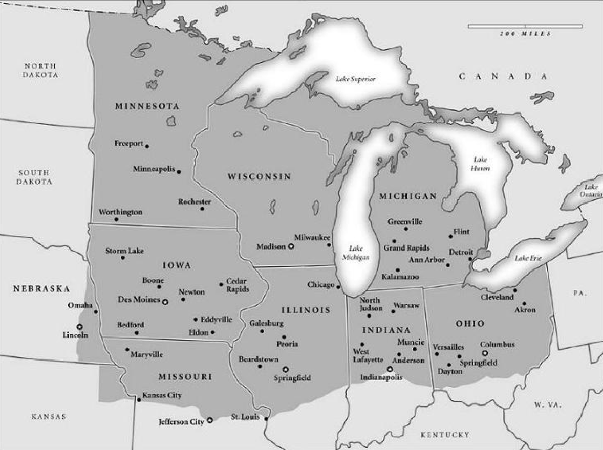
During a time in my life when I was driving back and forth between Minneapolis and the west coast fairly often, I formulated my own theory: when you start seeing guys wearing seed hats instead of cowboy hats, you've passed from the west into the midwest. Typically, if driving I-90, this would occur somewhere around Worthington, MN, which is to say just a bit east of the South Dakota border. But I haven't really paid attention to this when driving I-94, so I can't say for sure about NoDak.
posted by Kat Allison at 5:19 PM on November 25, 2015 [1 favorite]
The line literally comprises the border between PA and MD.
Yes... but I've heard it said the Mason-Dixon line moved down to the Potomac River a long time ago. A better delineation now might be the Grits Line (below it, grits are available in restaurants) and I also agree with hangingbyathread's iced tea definition.
posted by Rash at 9:37 PM on November 25, 2015
where would you place North Dakota?
Partly from geography but mostly from how people talk, I'd place it as midwest (in a really big picture sense), or related to the eastern side of states like Colorado (in a more fine-grained sense). The Dakotas are on the wrong side of the mountains to be included in the west (whether intermountian, northwest, etc) and culturally don't fit. But quite a few states are split and contain both -- Montana, Wyoming, Colorado, etc -- so there are political and cultural affiliations that don't follow geographical lines, and vice versa.
posted by Dip Flash at 12:16 AM on November 26, 2015
The Grits-No Grits line.
The Sweet Tea-Iced Tea line.
The IHOP-Waffle House line.
The Sheetz-WaWa line.
Surely there are even more examples or mundane cultural differences with a weirdly-sharp geographic division...
posted by schmod at 4:49 PM on November 26, 2015 [1 favorite]
The Sweet Tea-Iced Tea line.
The IHOP-Waffle House line.
The Sheetz-WaWa line.
Surely there are even more examples or mundane cultural differences with a weirdly-sharp geographic division...
posted by schmod at 4:49 PM on November 26, 2015 [1 favorite]
The Canadian sphere of influence (Hockey is popular and Tim Hortons has stores in these places)
posted by schmod at 4:49 PM on November 26, 2015
posted by schmod at 4:49 PM on November 26, 2015
The IHOP-Waffle House line: I must have found a point on this line a month ago. Oak Ridge TN has both, nearly across the street from each other. (My first time in a WH)
posted by ctmf at 4:56 PM on November 26, 2015 [1 favorite]
posted by ctmf at 4:56 PM on November 26, 2015 [1 favorite]
Hardee's-Carl's Jr line
Best Foods-Hellmann's line
posted by ctmf at 5:08 PM on November 26, 2015 [1 favorite]
Best Foods-Hellmann's line
posted by ctmf at 5:08 PM on November 26, 2015 [1 favorite]
Having lived in Louisiana, Alabama, Missouri, and Texas as well as a handful of western and northern states, I can definitively state that Maryland belongs to the south:
Talbot Boys statue [honoring those who served the Confederate States of America] to remain on Easton courthouse lawn - Baltimore Sun, 11/25/15
posted by postel's law at 4:04 AM on November 27, 2015
Talbot Boys statue [honoring those who served the Confederate States of America] to remain on Easton courthouse lawn - Baltimore Sun, 11/25/15
posted by postel's law at 4:04 AM on November 27, 2015
The IHOP-Waffle House line: I must have found a point on this line a month ago. Oak Ridge TN has both, nearly across the street from each other. (My first time in a WH)
It's not really a line. If anywhere is the core of Waffle House territory, it's Atlanta, but here are a Waffle House and an IHOP 0.3 miles apart near an exit on I-85 just northeast of Atlanta.
posted by madcaptenor at 9:52 AM on November 28, 2015
It's not really a line. If anywhere is the core of Waffle House territory, it's Atlanta, but here are a Waffle House and an IHOP 0.3 miles apart near an exit on I-85 just northeast of Atlanta.
posted by madcaptenor at 9:52 AM on November 28, 2015
selfmedicating: "For example, I'd say Pittsburgh has a lot more in common with Detroit and Youngstown than it does with Philly, despite being in the same state as Philly."
Well, that's not terribly surprising, given that Pittsburgh to Youngstown is 60-odd miles, and Pgh to Philly is over 300 miles.
Pittsburgh is definitely not the Midwest. The Midwest starts somewhere between Pittsburgh and Columbus.
posted by Chrysostom at 9:40 PM on November 28, 2015
Well, that's not terribly surprising, given that Pittsburgh to Youngstown is 60-odd miles, and Pgh to Philly is over 300 miles.
Pittsburgh is definitely not the Midwest. The Midwest starts somewhere between Pittsburgh and Columbus.
posted by Chrysostom at 9:40 PM on November 28, 2015
All jokes aside, I'll concede that Maryland, as tiny as it is, has a lot of diverse cultures that one can pull from to claim it for the north or the south. Montgomery County, the state's richest county (and one of the country's richest counties), just sent a letter to the US Office of Refugee Resettlement stating the county will welcome Syrian refugees. Meanwhile, if you stop by the smaller towns on your way north to Wisp Ski Resort, you might spot a few Confederate flags.
The IHOP-Waffle House line
Maryland's southern most Waffle House is in Frederick, which is pretty far north of most IHOPs in the state.
posted by numaner at 3:40 PM on November 30, 2015
The IHOP-Waffle House line
Maryland's southern most Waffle House is in Frederick, which is pretty far north of most IHOPs in the state.
posted by numaner at 3:40 PM on November 30, 2015
I drive past an IHOP, then a Waffle House, on my way to work every day. Less than a quarter-mile apart. Crucially the IHOP is on the north side of the road, the Waffle House on the south.
posted by fantabulous timewaster at 11:44 PM on December 4, 2015
posted by fantabulous timewaster at 11:44 PM on December 4, 2015
numaner: "Maryland's southern most Waffle House is in Frederick, which is pretty far north of most IHOPs in the state."
Huh. So it is. I'd somehow written one into my memory of Rockville.
(Haha. J/K. Everything in Rockville closes at 10, so there's no way that'd be plausible.)
posted by schmod at 7:13 AM on December 11, 2015
Huh. So it is. I'd somehow written one into my memory of Rockville.
(Haha. J/K. Everything in Rockville closes at 10, so there's no way that'd be plausible.)
posted by schmod at 7:13 AM on December 11, 2015
Boy, sounds like the kind of place you would not want to waste another year.
posted by Chrysostom at 7:36 AM on December 11, 2015
posted by Chrysostom at 7:36 AM on December 11, 2015
A better delineation now might be the Grits Line (below it, grits are available in restaurants)
Didn't notice it before, but I've been to a number of proper Jersey diners where grits are available.
posted by graymouser at 4:40 PM on December 11, 2015
Didn't notice it before, but I've been to a number of proper Jersey diners where grits are available.
posted by graymouser at 4:40 PM on December 11, 2015
(Haha. J/K. Everything in Rockville closes at 10, so there's no way that'd be plausible.)
Not anymore! The town center has an actual club! And the bars there close at 1 AM! They're moving up in the world!
posted by numaner at 9:03 PM on December 11, 2015
Not anymore! The town center has an actual club! And the bars there close at 1 AM! They're moving up in the world!
posted by numaner at 9:03 PM on December 11, 2015
« Older StoryCorps Launches "The Great Thanksgiving... | Hugh. George. Matthew. Johnny. Ryan. Bradley.... Newer »
This thread has been archived and is closed to new comments
The official geographic center is in South Dakota, and the center of the contiguous US is in Kansas, but you do have the population center! I'd back that proposal.
posted by everybody had matching towels at 2:36 PM on November 24, 2015 [1 favorite]