Historical political maps
September 2, 2010 9:51 AM Subscribe
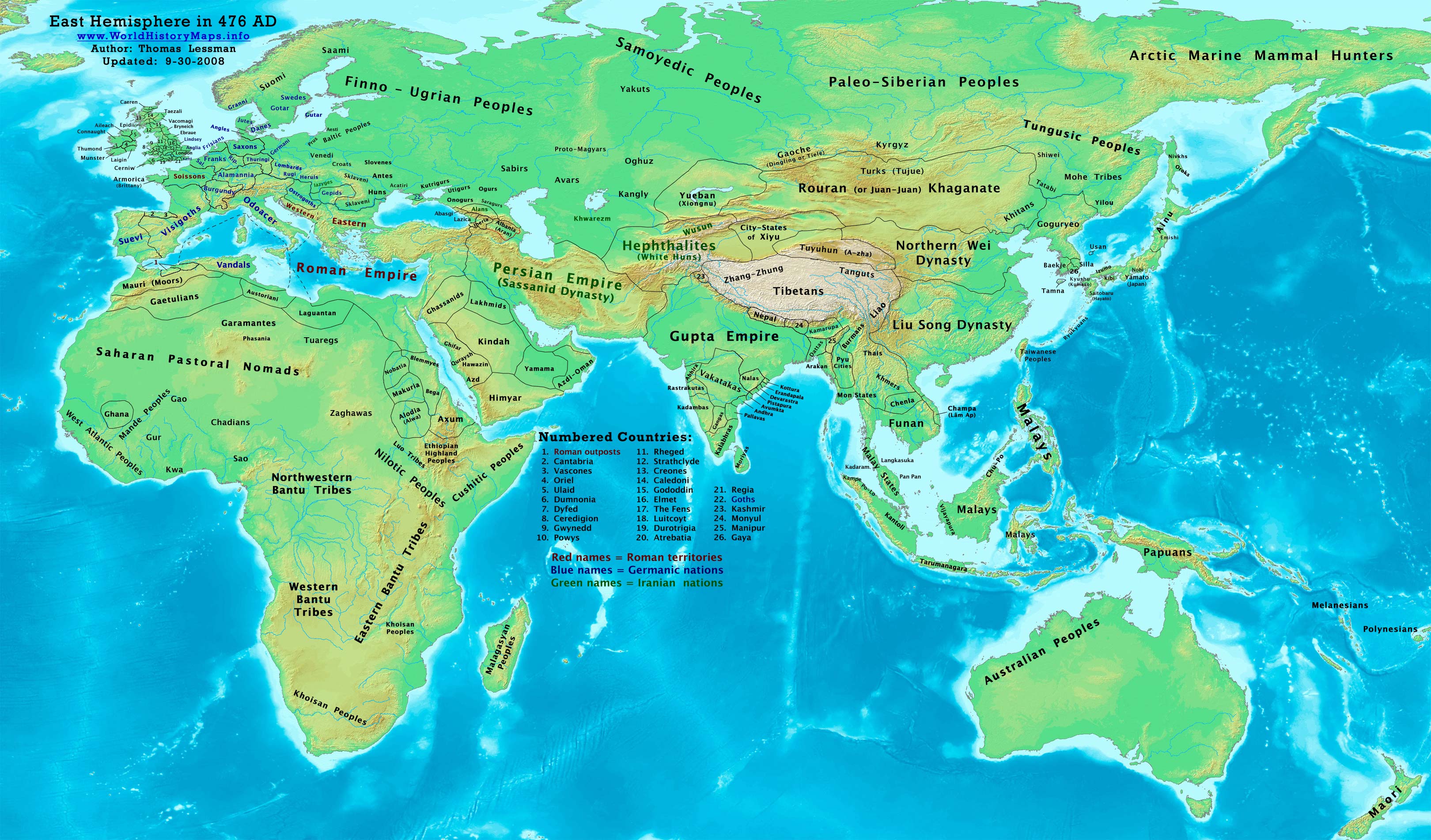
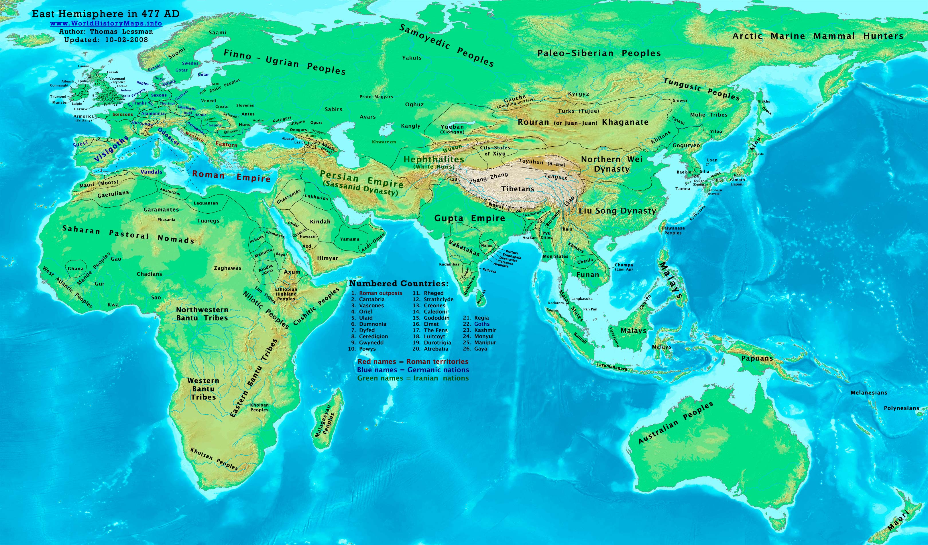
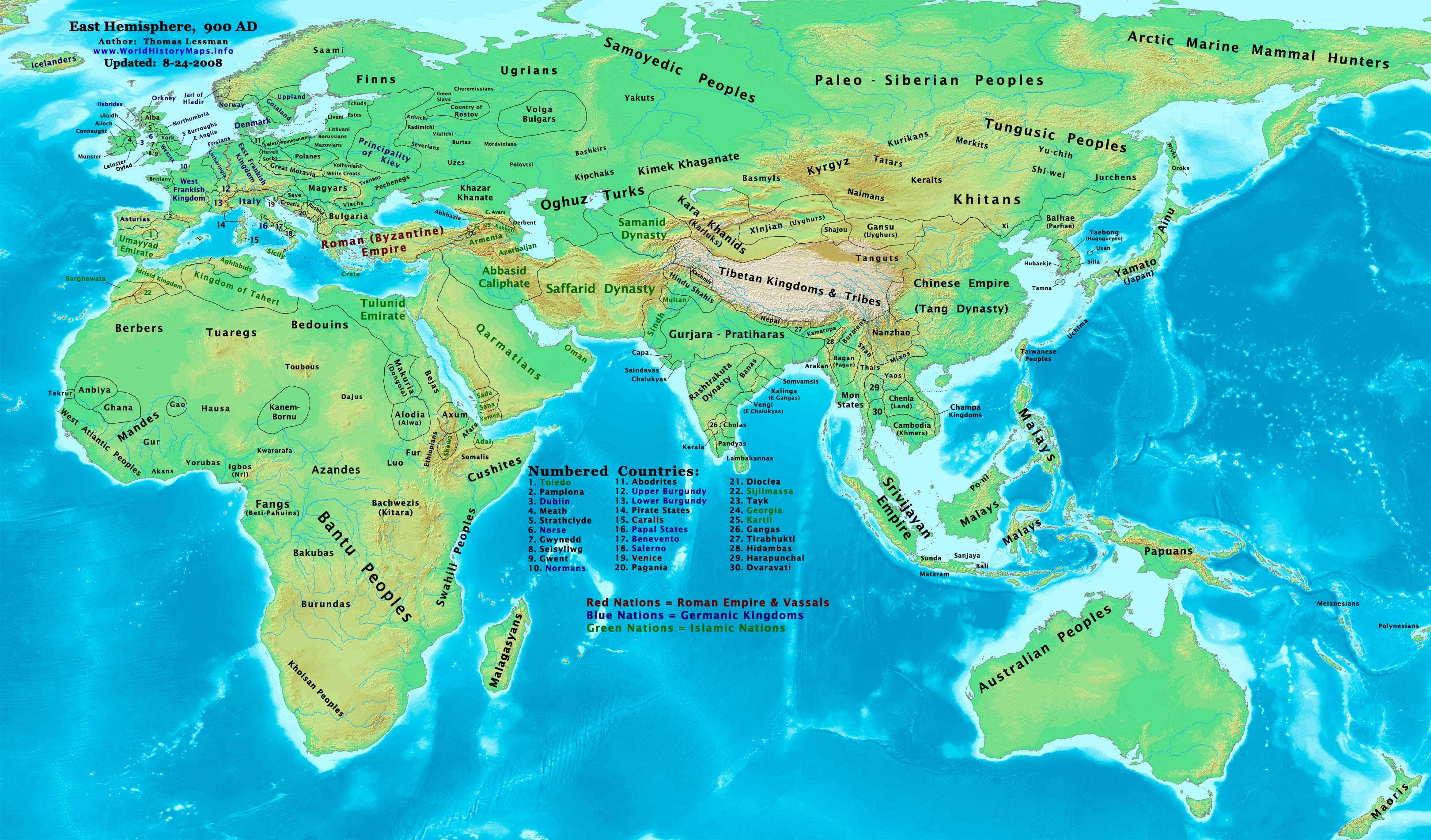
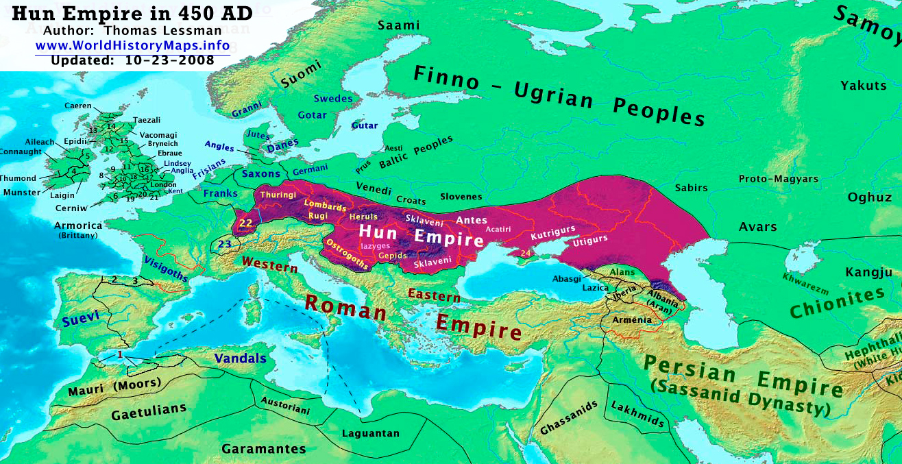
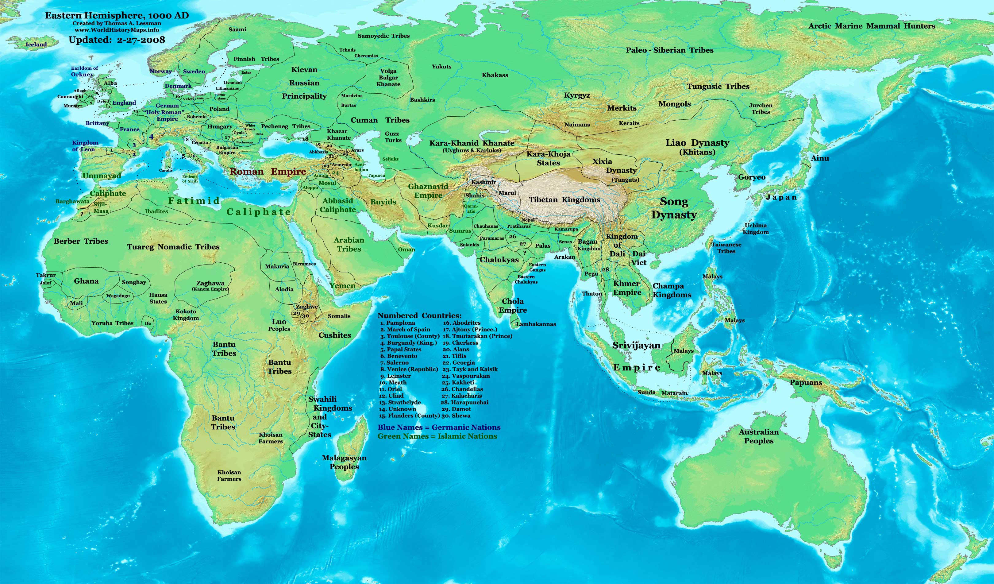
Thomas Lessman presents a selection of political maps of Europe, Asia and Africa throughout ancient and mediaeval history. Watch the changes on the map through the fall of Rome, peruse the patchwork of kingdoms in Southeast Asia at the heyday of the Srivijaya Empire, or check out just how much land Attila ruled at the height of his power. Some of his references have some good stuff as well, including more detailed maps of Europe for the last two millennia, as well as the staggeringly comprehensive Friesian history website previously linked on the blue.
awesome and bookmarked, thanks!!
posted by supermedusa at 10:09 AM on September 2, 2010
posted by supermedusa at 10:09 AM on September 2, 2010
Now I want a new pony: the ability to Super Favorite.
posted by bearwife at 10:12 AM on September 2, 2010
posted by bearwife at 10:12 AM on September 2, 2010
This is a fabulous reasource, THANKS!
posted by Katjusa Roquette at 10:13 AM on September 2, 2010
posted by Katjusa Roquette at 10:13 AM on September 2, 2010
Great maps -- thanks for telling us about this awesome web site!
If you enjoy this sort of thing and want something for your coffee table, you will love the classic The New Penguin Atlas of Medieval History. I seldom manage to close that book within one hour of opening it.
posted by Triplanetary at 10:51 AM on September 2, 2010
If you enjoy this sort of thing and want something for your coffee table, you will love the classic The New Penguin Atlas of Medieval History. I seldom manage to close that book within one hour of opening it.
posted by Triplanetary at 10:51 AM on September 2, 2010
Its about time.
posted by General Tonic at 10:53 AM on September 2, 2010
posted by General Tonic at 10:53 AM on September 2, 2010
Hrm. While I very much like the maps of Europe, I'm not so sure the larger eastern hemisphere maps are totally accurate: Lessman has Maori colonising New Zealand in 475AD, whereas oral histories and archeological evidence has Polynesians making landfall there no earlier than the 13th century.
To this selection I would also add the interactive, animated maps of Spielvogel, along with the excellent narrated The Map As History and Maps of War.
posted by Bora Horza Gobuchul at 11:06 AM on September 2, 2010 [4 favorites]
To this selection I would also add the interactive, animated maps of Spielvogel, along with the excellent narrated The Map As History and Maps of War.
posted by Bora Horza Gobuchul at 11:06 AM on September 2, 2010 [4 favorites]
The maps detailing times past were always my favorite part of my World History textbook in 9th grade. The only thing I would like more than the maps provided here is if these maps were animated.
(someone point me in that direction?)
posted by not_on_display at 11:11 AM on September 2, 2010
(someone point me in that direction?)
posted by not_on_display at 11:11 AM on September 2, 2010
. . . Thanks, Bora Horza Gobuchul!
posted by not_on_display at 11:12 AM on September 2, 2010
posted by not_on_display at 11:12 AM on September 2, 2010
The only thing I would like more than the maps provided here is if these maps were animated.
Google animated maps. There are plenty of them out there.
posted by IndigoJones at 5:08 PM on September 2, 2010
Google animated maps. There are plenty of them out there.
posted by IndigoJones at 5:08 PM on September 2, 2010
« Older Breaking News: Another Oil Rig Explodes in the... | The Victor Borge Website Inflniner Newer »
This thread has been archived and is closed to new comments
Hang in there, Arctic Marine Mammal Hunters!
posted by Gator at 9:58 AM on September 2, 2010 [1 favorite]