GMaps @ 10
February 12, 2015 8:50 AM Subscribe
For me personally, this is an interesting example of humans' flawed sense of the passage of time. I founded a still-running website just shy of 10 years ago, and I remember seeing Google Maps beta when it was first released. The former feels much further in the past than the latter.
posted by Hot Pastrami! at 9:24 AM on February 12, 2015 [3 favorites]
posted by Hot Pastrami! at 9:24 AM on February 12, 2015 [3 favorites]
With wacky traffic and more wacky roads around Boston I crack open gmaps constantly. Just terrified that it'll go the way of Orkut, moved to a crazy pricing model or just vanish. OpenStreetMaps is a fine and noble endeavor but just isn't gmaps. The UI of the other online maps makes me want to break my fingers. Google might not not be evil but it's our not evil megacorporation.
posted by sammyo at 9:27 AM on February 12, 2015 [1 favorite]
posted by sammyo at 9:27 AM on February 12, 2015 [1 favorite]
For me personally, this is an interesting example of humans' flawed sense of the passage of time.
I was going to comment about how in the SNL/Lonely Island video Lazy Sunday, they mention Mapquest and Yahoo Maps and then, as almost an afterthought, Say "Google Maps is the Best."
I went to look up when it was released and... holy shit... 2005! So yeah, time is sort of an asshole sometimes.
When was the last time anyone used Mapquest or Yahoo Maps for anything?
posted by bondcliff at 9:32 AM on February 12, 2015 [2 favorites]
The last time I tried to use a non-Google Maps it was Apple's then-newly-released competitor on my phone and instead of taking me to the Fry's in Burbank it took me to an abandoned gas station in a bad part of downtown LA.
posted by Ghostride The Whip at 9:34 AM on February 12, 2015 [8 favorites]
posted by Ghostride The Whip at 9:34 AM on February 12, 2015 [8 favorites]
How long before there's a weather overlay, realtime traffic mapping, integration with GPS for commercial use..Heh heh.
posted by MrMoonPie at 9:37 AM on February 12, 2015 [3 favorites]
Yahoo Maps for anything?
I use two different browsers at work and one has the default search set to Yahoo (the other to DuckDuckGo). I end up in Yahoo Maps occasionally. My phone is set use bing for search so I use their maps sometimes, too. Still, the main map app I use on my phone and at home is Google Maps, but I haven't noticed anything horrible about the other two.
posted by soelo at 9:39 AM on February 12, 2015
"Google Maps is the Best."
True dat.
Double true!
posted by ricochet biscuit at 9:46 AM on February 12, 2015 [15 favorites]
True dat.
Double true!
posted by ricochet biscuit at 9:46 AM on February 12, 2015 [15 favorites]
Ten years is only 1/5 of my life but I find it hard now to remember what life was like before Google Maps.
posted by octothorpe at 9:51 AM on February 12, 2015 [4 favorites]
posted by octothorpe at 9:51 AM on February 12, 2015 [4 favorites]
Google Maps's ability to just drag around the map without refreshing was a revelation. It really was the first experience I had with a site that felt more like an app than a bunch of pages. And from reading the article, it looks like the Where2 people did it in the three weeks before presenting to Google.
posted by zsazsa at 9:51 AM on February 12, 2015 [4 favorites]
posted by zsazsa at 9:51 AM on February 12, 2015 [4 favorites]
like gmail, gmaps is one of those things where it just gets worse with every iteration. i actively avoid going to gmaps on computer because it slows down the browser on older computers to the point where it is hard to use and the interface is, while attractive, frustrating to use even on better machines.
in addition, since google is in the internet data business and I don't have a data plan for my phone, the ways in which they have made gmaps for android functionally useless for offline use are maddening. if you live without a data plan or in an area where cellphone service is spotty, much less data, then nokiaMS's HERE is totally superior for car navigation just because of this.
also, i'm afraid of updating 'maps' on my phone for fear of what google may have done this time... google maps, something which used to be great, now sucks, but is the only game in town because monopoly economics.
posted by ennui.bz at 10:00 AM on February 12, 2015 [12 favorites]
I'm sort of amazed that all of the maps.google.com links in this 2005 thread still work.
posted by theodolite at 10:02 AM on February 12, 2015 [1 favorite]
posted by theodolite at 10:02 AM on February 12, 2015 [1 favorite]
I still hear people say "mapquest it" and they're talking about using any map service besides mapquest, probably. MQ sucked in many ways but it verbed really well.
posted by stupidsexyFlanders at 10:03 AM on February 12, 2015
posted by stupidsexyFlanders at 10:03 AM on February 12, 2015
When was the last time anyone used Mapquest or Yahoo Maps for anything?
We have a fair amount of new development in my area, and often it's a tossup as to which service will have the new streets listed (or at least searchable) first. Often, Google Maps will return no search result for a new street, but then I can find it in Mapquest, return to Google Maps and zoom in on the area and there the street is, on the map but apparently not indexed yet.
posted by gimli at 10:04 AM on February 12, 2015 [1 favorite]
I was totally into Keyhole before they sold out.
posted by Kabanos at 10:05 AM on February 12, 2015 [5 favorites]
posted by Kabanos at 10:05 AM on February 12, 2015 [5 favorites]
When Google maps came out, I mentioned it was cool to my boss at %RIVAL_SOFTWARE_COMPANY%, and got yelled at for so much as looking at a competitor's product instead of buying our company's far inferior product...
posted by Blue Jello Elf at 10:08 AM on February 12, 2015
posted by Blue Jello Elf at 10:08 AM on February 12, 2015
When was the last time anyone used Mapquest or Yahoo Maps for anything?
Every now and then, I'll click on a Directions link on some business's website and think, "Huh, Google Maps changed its look again-- oh, no, wait, it's fucking Mapquest." And then I close the window immediately and look it up on Google Maps, because then it will pop right up on the app when I'm driving to the place.
posted by Etrigan at 10:14 AM on February 12, 2015
Seconding the love for HERE on Android. It's now my GPS app of choice; the only thing I use the Gmaps app for anymore is to see what else is nearby (restaurants or gas stations, for example) wherever I end up.
posted by Greg_Ace at 10:19 AM on February 12, 2015 [1 favorite]
posted by Greg_Ace at 10:19 AM on February 12, 2015 [1 favorite]
Sergey eventually gets up and unplugs the projector, says ‘This thing’s cool and we should buy it,’ and he plugs his laptop into the projector and shows us Keyhole. And, literally, these executives are shouting out their addresses because they want to zoom in on their houses from space.”Everyone who I ever showed Google Maps to in the early days had the exact same reaction.
posted by Rock Steady at 10:19 AM on February 12, 2015 [2 favorites]
There really is an XKCD for everything.
posted by EmpressCallipygos at 10:32 AM on February 12, 2015 [4 favorites]
posted by EmpressCallipygos at 10:32 AM on February 12, 2015 [4 favorites]
It feels like we've had Google Maps forever, but I'm always amazed when I look back at my AskMe posting history and I'm reminded that there was no answer to this question in 2004: http://ask.metafilter.com/8211/Where-can-I-find-an-online-map-or-atlas
posted by TurkishGolds at 10:33 AM on February 12, 2015 [6 favorites]
posted by TurkishGolds at 10:33 AM on February 12, 2015 [6 favorites]
> OpenStreetMap is a fine and noble endeavor but just isn't gmaps
Well's it's older, for one thing. And the routing's getting better, but considering it's running on a a small handful of donated servers, it's still bloody marvellous. Google can still splat ads over the maps they serve to your domain, too.
But one thing from the announcement made me laugh: "... passionate communities like Map Maker" ... srsly? Mapmaker in my area is all SEO spam and old OpenStreetMap edits lifted in the hope that no-one will notice.
posted by scruss at 10:45 AM on February 12, 2015 [1 favorite]
Google maps might be the best, but for work I often use Bing Maps for its 'Birds Eye' view feature - high resolution aerial photographs of a city from SW-SE-NE-NW that are a great resource for studying building sites and neighbourhoods. Their straight-down aerial photographs are sometimes better too.
posted by Flashman at 10:47 AM on February 12, 2015 [2 favorites]
posted by Flashman at 10:47 AM on February 12, 2015 [2 favorites]
"like gmail, gmaps is one of those things where it just gets worse with every iteration. i actively avoid going to gmaps on computer because it slows down the browser on older computers to the point where it is hard to use and the interface is, while attractive, frustrating to use even on better machines."
Holy crap! I literally just found this: If you click on the question mark icon on the bottom of Google Maps you get the option to revert back to Google Maps Classic! And it also asks you why you want to revert and "too slow" is one of the options.
posted by I-baLL at 11:03 AM on February 12, 2015 [8 favorites]
There was a nice article by local PDX paper Willamette Week, publishing some then-and-now shots of Portland, as seen through seven years of Google StreetView. The parking lot at 10th and Washington looks really spare in 2007 without all of the food carts!
posted by fifteen schnitzengruben is my limit at 11:19 AM on February 12, 2015 [1 favorite]
posted by fifteen schnitzengruben is my limit at 11:19 AM on February 12, 2015 [1 favorite]
I-baLL - thankyouthankyouthankyouthankyouthankyouthankyouthankyou!!
posted by Greg_Ace at 11:22 AM on February 12, 2015 [1 favorite]
posted by Greg_Ace at 11:22 AM on February 12, 2015 [1 favorite]
Ten years. Huh.
Today when I open a new tab to look at google maps it takes all of four keystrokes: CTRL+n > m > ENTER.
It shows me my home, my work, and offers directions to my last few local google searches. If only my phone weren't three years old and barely creaking along, I'd have all of this in my pocket too. It's like the computer in The Diamond Age, growing to know me and guide me through this crazy world. I feel a little shmoopy about living in such a cool future, and more than a little nervous that I should feel more suspicious of it than I do.
Ten years ago my friend was planning to move to Los Angeles from our hometown. She had a job nailed down, and was just back in town from a trip out to find a place to live. We sat down in front of my computer and I showed her google maps (and the earth program, which was straight out of my favorite book back then) and we saw where she would work and where she would live and looked at everything in between. We looked at the Matterhorn, and Universal Studios, and the campus of the college our other friend attended. We talked about her commute options ("You could walk it's so close!"), parks in her area ("Like in the song?"), where she would get groceries ("I think it's called Ass Mart?"), etc. Then she moved out there and oriented herself and reported back to me that walking between Koreatown and Downtown Los Angeles wasn't feasible even though it was only 1.5 miles, that MacArthur Park is better than it was but still kind of crazy, and that she preferred the TJ's several miles away to any of the closer 24-hour supermarkets.
There's a lot of power and freedom in knowing your environment and surroundings better. It's why my family all encouraged me to have a Peterson's under my seat in the car at all times, even after I could do the same (only better, thanks Google) on my phone. It's wonderful that that power and freedom is more readily available to people and even more information-rich than ever before. But it's also good to remember to look up and take in what you see around you, because the map is not the terrain.
posted by carsonb at 11:35 AM on February 12, 2015 [4 favorites]
Nuts. I have a very distinct memory of using specific Google Maps features to find an apartment from 9 years ago. I never would have guessed it was only a year old at that time though!
posted by miyabo at 11:48 AM on February 12, 2015
posted by miyabo at 11:48 AM on February 12, 2015
I never got the chance to use any of the precursors to Google Maps- i was 14 or 15 when this thread was posted. I still try to appreciate how well it functions, though, as part of the not-taking-things-for-granted mindset. I suppose that corporations letting me use amazing products entirely for free is just something my generation grew up with.
Definitely remember the first time I used Street View as a teen though; was playing around on it for hours.
posted by The Zeroth Law at 11:56 AM on February 12, 2015
Definitely remember the first time I used Street View as a teen though; was playing around on it for hours.
posted by The Zeroth Law at 11:56 AM on February 12, 2015
The Google Maps big-canvas click-and-drag-forever model seems so amazingly intuitive that it's hard to remember what came before from MapQuest etc. Little poky squares of maps that you would navigate like an adventure game, each click taking you one square north/northeast etc, and each click reloading the entire damn page.
Online maps used to be painful to use before GMaps shook them up.
posted by We had a deal, Kyle at 12:05 PM on February 12, 2015 [4 favorites]
Online maps used to be painful to use before GMaps shook them up.
posted by We had a deal, Kyle at 12:05 PM on February 12, 2015 [4 favorites]
My Dad will still mapquest things. Well, he'll say, as we get into the car and he hands me the directions (I'm the designated navigator), "Here, I printed out the Mapquest". If I mention that he probably didn't actually use Mapquest he'll say "Y'know, Google map". The printout usually says "Bing" across the top.
posted by benito.strauss at 12:42 PM on February 12, 2015 [2 favorites]
posted by benito.strauss at 12:42 PM on February 12, 2015 [2 favorites]
It's easy to bash Mapquest now, but those neatly printed lists of directions, with a little mini map of your destination were just as revolutionary in the pre-GPS device era.
posted by Rock Steady at 12:57 PM on February 12, 2015 [1 favorite]
posted by Rock Steady at 12:57 PM on February 12, 2015 [1 favorite]
> The Google Maps big-canvas click-and-drag-forever model seems so amazingly intuitive that it's hard to remember what came before from MapQuest etc.
If you miss the old way, streetmap.co.uk still does it like that.
posted by scruss at 1:25 PM on February 12, 2015
If you miss the old way, streetmap.co.uk still does it like that.
posted by scruss at 1:25 PM on February 12, 2015
The Recode story was great. I loved this part of the story about the street mapping team:
When the first push was done, for American map data, Quinn sent out an email to every Google employee. She asked them to test the maps in their hometowns, their college towns, anywhere they had lived. For every bug they found, she would bake and send a chocolate-chip cookie.
“I just spent a whole weekend making cookies,” recalls Quinn, now a partner at Kleiner Perkins. “I home-made 7,000 chocolate-chip cookies.”
Although now that I think about it ... hm. Maybe three dozen at once in a big oven. So a bit under 200 baking cycles, at around 10 minutes per cycle. So that's 2000 minutes, which is, uh ... 33 1/3 hours ... did you guys know I'm buying a turntable this weekend? Seriously, the audio technica LP120 ... uh ... so anyway do you all think she *really* made 7,000 cookies? The math makes it *just* possible. Or was she in the other helicopter?
posted by freecellwizard at 1:27 PM on February 12, 2015
Actually this is good too:
The three deals were led by Page and Megan Smith, who is now CTO of the United States
I love reading that for multiple reasons.
posted by freecellwizard at 1:30 PM on February 12, 2015 [1 favorite]
The three deals were led by Page and Megan Smith, who is now CTO of the United States
I love reading that for multiple reasons.
posted by freecellwizard at 1:30 PM on February 12, 2015 [1 favorite]
I still miss the old Google Maps app for the iPhone - yes, I know there is a new app made by Google, but it takes a long time to load up and generally just feels slower - the tiles take longer to load, it has to do all this fancy 3D building jazz...
posted by pravit at 3:25 PM on February 12, 2015
posted by pravit at 3:25 PM on February 12, 2015
There were actually libraries to make slippy maps before Google Maps released. ka-map! was pretty cool at the time. Getting any sort of decent data was a real pain in the ass, though, even if you did have the motivation to set up a geospatial database, map renderer, and all that.
These days, even the Census Bureau's TIGER data has gotten pretty darn good, but why bother?
posted by wierdo at 3:42 PM on February 12, 2015 [1 favorite]
These days, even the Census Bureau's TIGER data has gotten pretty darn good, but why bother?
posted by wierdo at 3:42 PM on February 12, 2015 [1 favorite]
> There were actually libraries to make slippy maps ...
and if you still feel the need, the most ridiculously simple is Leaflet. For a very simple intro, Let's make some web maps using Leaflet.js! If you're a QGIS user, qgis2leaf is a joy.
posted by scruss at 5:57 PM on February 12, 2015 [1 favorite]
and if you still feel the need, the most ridiculously simple is Leaflet. For a very simple intro, Let's make some web maps using Leaflet.js! If you're a QGIS user, qgis2leaf is a joy.
posted by scruss at 5:57 PM on February 12, 2015 [1 favorite]
How many of y'all are on streetview? Here's me!
posted by MrMoonPie at 6:38 PM on February 12, 2015 [1 favorite]
posted by MrMoonPie at 6:38 PM on February 12, 2015 [1 favorite]
This was post-dot-com bust. Lars and his brother were totally broke. Due to visa issues, they were building Where2 in Australia with two engineers named Noel Gordon and Stephen Ma. Without funding, the startup was going under.
My housemate Nick tells a cute story about Lars and Sven. At that time, they were staying (for free) with Nick and his family at his house in Sydney, as Lars was dating a good friend of Nick's wife. The two brothers rarely interacted with the rest of the residents there (Sven especially) and instead remained glued to their laptops all hours of the day, working on a project that had "something to do with maps, and stitching together satellite photos, which had recently become available."
Nick's too nice a guy to put them out, and although they stayed more or less rent-free for about a year, there was always this thought that they were on the verge of hitting it big.
Needless to say, they did.
Nowadays, Nick lives in L.A., and when he visits Sydney, it is he who stays for free in Lars' palatial home at the marina. Lars visits us a couple of times per year, usually by private jet.
Meanwhile, I begin to get the sense that Nick is looking at me every day, wondering when it might be my turn to invent something...
posted by ShutterBun at 9:04 PM on February 12, 2015 [3 favorites]
Footnote: Lars Rasmussen went on to develop the less-awesomely received Google Wave a couple of years ago. Sophomore slump, I guess.
posted by ShutterBun at 9:05 PM on February 12, 2015
posted by ShutterBun at 9:05 PM on February 12, 2015
Google maps is great. Combined with voice search it is wonderful. I was once driving with someone in a strange place and he wanted a steak, so I just said 'steak' and Google maps showed me how to get to a nearby wonderful steakhouse. It was like magic.
But...
If you are disconnected from the Internet, Google maps is useless. "But you can download areas into cache" people will tell you. So I do this so I can find my way to a place my sister is visiting in the Santa Cruz mountains. Then she says "lets drive down to downtown Santa Cruz. You can follow me." And I do, and she drives off and is gone, and I've driven past the Google cache, the Internet is far away, and Google Maps has absolutely no clue where we are or how to get anywhere.
Nokia Here is a nice, free, backup for these kinds of situations. You can put the whole US in there if you want (and many other countries too).
posted by eye of newt at 12:55 AM on February 13, 2015 [1 favorite]
I'm in the GIS biz and was a little surprised at how gm turned some pretty orthodox ideas over very quickly:
The UX lesson was made utterly clear to a bunch of dumbfounded system architects caught with their pants down: people mostly don't care. about content, about layer order, about variable symbology, about turning on and off layers, about regionally specific projections, about world maps that show the whole world.
If it won't render fast, no one will use it. and if there's one thing google maps does well...
posted by j_curiouser at 2:58 AM on February 13, 2015 [8 favorites]
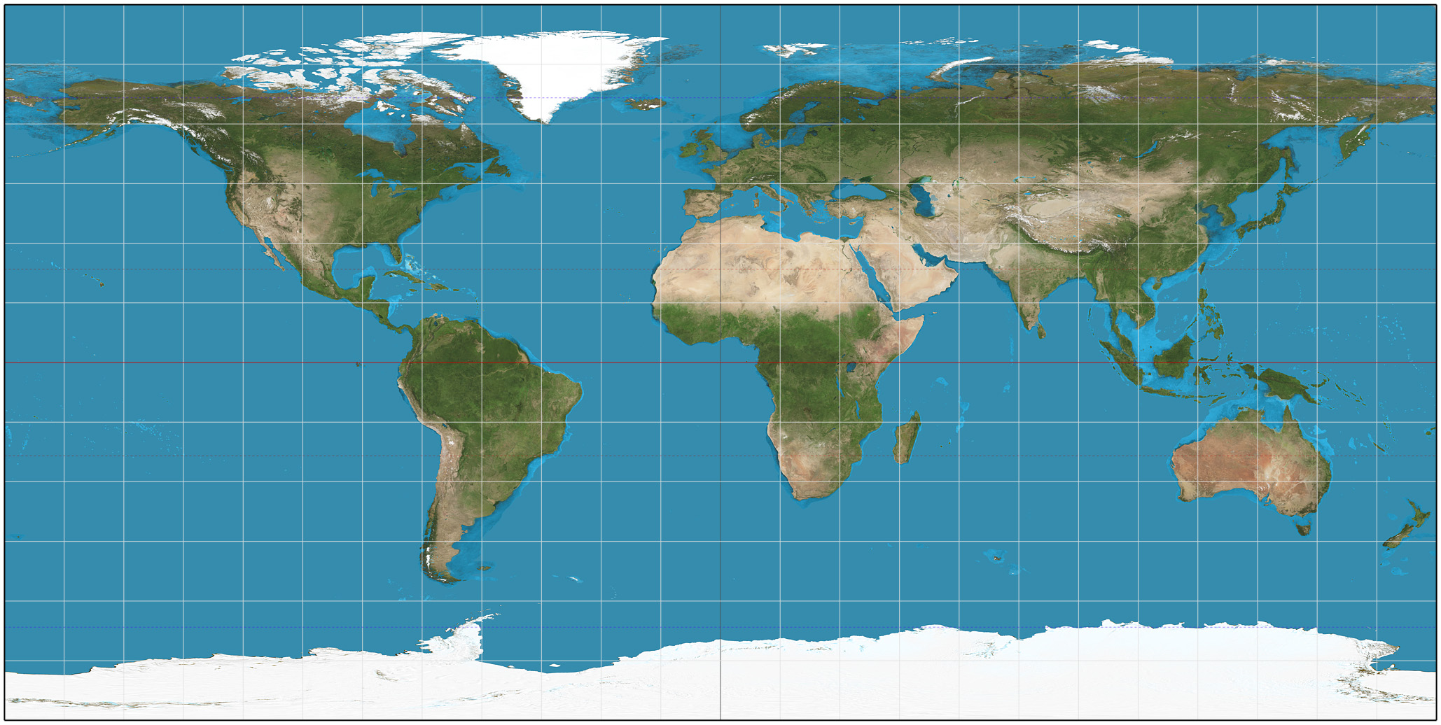
- While a majority of the GIS community had capitalized on projection engines to tailor regional maps, or on platte-caree to show a complete world map - gm did the simplest thing possible - a mercator projection - freshly invented around 1500 for your contemporary internet needs. just like from your third-grade classroom wall. and as always, nobody fucking cares how big greenland is. further, a 'world' map in mercator is not. the world outside +/- 85 deg latitude cannot be rendered in mercator - it is not mathematically possible. gm uses a 'modified mercator' to fake-in the missing bits. familiarity == mindshare. accuracy and completeness not so much.
- geo-centric teams lauded the abilities to zoom to any scale, change elements displayed, and modify the legend and symbols. this meant that a map could be tailored for the user throughout a session. think 'modifying css on the fly to *see what it looks like*'. gm abandoned those features in favor of fixing the available zoom levels, fixing the design, and fixing the content. then they could render each possible jpeg. tiled together, they make the seamless map we see on gm. this process created the most popular and critical feature for web mapping: speed. without having to 'draw' each map for each user on-demand, its jpegs all the way down [or whatever image format]. speed, baby, speed.
- gm split the map content: the basemap underneath, then anything interesting layered on top of that. so you could still capitalize on speed, and customize content separately. un-integrated content, laying on top of the basemap. pushpins for your favorite dog parks, say. more commonly at that time, one would sandwich the dog parks into the map layers at a symbolically appropriate level, or at a semantically appropriate level (e.g. next to people parks, and horse parks). Suddenly, everything - no matter it's actual physical geometry - was simplified to a point (push-pin-style yo).
The UX lesson was made utterly clear to a bunch of dumbfounded system architects caught with their pants down: people mostly don't care. about content, about layer order, about variable symbology, about turning on and off layers, about regionally specific projections, about world maps that show the whole world.
If it won't render fast, no one will use it. and if there's one thing google maps does well...
posted by j_curiouser at 2:58 AM on February 13, 2015 [8 favorites]
Yep; “Raster is faster; vector is correcter”
posted by scruss at 4:18 AM on February 13, 2015 [1 favorite]
posted by scruss at 4:18 AM on February 13, 2015 [1 favorite]
If you are disconnected from the Internet, Google maps is useless.
Very true. There's like...a shitload of websites that could apply to.
posted by ShutterBun at 4:45 AM on February 13, 2015
Very true. There's like...a shitload of websites that could apply to.
posted by ShutterBun at 4:45 AM on February 13, 2015
Yes, but I'm less likely to urgently need Amazon or Metafilter in a no connectivity area than a mapping tool.
posted by Chrysostom at 6:49 AM on February 13, 2015
posted by Chrysostom at 6:49 AM on February 13, 2015
« Older Today's interesting footnote to history | Bugged by wanting to know who sung what on your... Newer »
This thread has been archived and is closed to new comments
posted by Keith Talent at 9:04 AM on February 12, 2015 [1 favorite]